
Trace a Brentwood Street Directory by Address
A reliable Brentwood street directory search moves from a location to a parcel before it moves to a person. Normalize the street, locate the parcel, carry its APN into the assessment roll, and use the legal description or party name in the recorder index. Only then compare voter information, permits, newspapers, or a historical directory. An address identifies a place; a deed identifies a legal interest.
- Enter the normalized Brentwood address in ParcelQuest Lite or the county property map, or start with an APN if one is already known.
- Open the same location in CCMAP or GeoVault, confirm the parcel outline, and save the APN, situs address, subdivision, and nearby parcel context.
- Ask the Contra Costa Assessor for the public assessment-roll entry when an owner name is needed. Keep the mailing address and the physical situs in separate notes.
- Carry the assessee, APN, and legal description into RecorderWorks, then search the deed, lien, map, or other instrument that fits the question.
- Compare the dated result with lawful voter channels, permit files, Brentwood News, and reverse or criss-cross directories rather than treating one hit as proof of residence.
Brentwood Street Directory Record Coverage
Different Brentwood custodians index different facts. Maps show geometry, the assessment roll supplies an assessee through the counter, the Clerk-Recorder indexes instruments, the Treasurer-Tax Collector keeps tax history, and Community Development dates projects. The table keeps land, permits, and people distinct.
| Record Set | Keeper | What It Shows | Access |
|---|---|---|---|
| Assessment roll and parcel card | Contra Costa Assessor | APN, assessee, mailing versus situs, value, and characteristics | ParcelQuest online by APN or address; owner names at the Martinez counter or by printout |
| CCMAP and ParcelQuest map | County Assessor and GIS | Boundary, APN, dimensions, value, map, aerial, and parcel context | Free online map; a staff radius report is available for a fee |
| Brentwood GeoVault | City of Brentwood | Address, parcels, zoning, annexations, subdivisions, districts, and footprints | Free guest map and map-click reports |
| Recorded documents | Contra Costa Clerk-Recorder | Parties, legal description, recording date, deeds, liens, and maps | Online index and ordering, Martinez counter, or recorder request channels |
| Tax bill and payment history | Treasurer-Tax Collector | Situs and legal description, January 1 assessee, tax status, and payment clues | APN or situs lookup online; counter, phone, and limited history-copy channels |
| Permits and planning files | Brentwood Community Development | Applicant, owner, contractor, work description, valuation, and project dates | Online tools where indexed; department counter or CPRA request when incomplete |
The shared key is the APN, not simply the street name. Use the map for land, the roll for the assessee, the recorder index for title events, and the city file for project dates. None proves a complete household.
Brentwood Assessor Search Fields
The Contra Costa Assessor services page explains the counter, map, and property-information role. The online county property route is narrower than a commercial directory: the public search accepts an APN or street address, but the county deliberately leaves owner names off its internet property map. That suppression is a real Brentwood access rule, not a failed search.
| Field or control | Type | Required | Format and result |
|---|---|---|---|
| Assessor's Parcel Number | Text | APN or address | Ten digits displayed as book, page, parcel, and check digit |
| Street Address | Text | APN or address | Situs address; a vacant parcel may have no street address |
| Owner Name | Unavailable online | Not applicable | Public assessment-roll access is through the Assessor counter or a permitted printout |
| Map or parcel select | Map click | Optional | CCMAP can identify a parcel and document radius capability |
Online outputs include boundary, assessed value, building square footage, lot size, aerials, contours, and assessor maps. Documented counter services include a $3 map, mailing for an added $2.50, a $50 radius search, a $1-per-page information printout, and a $7.50-per-parcel characteristics report. A free search and a paid copy are separate steps.
The Contra Costa property-information page starts the APN or address search. An assessee as of January 1 can lag a transfer, and a mailing address can belong to a trust, manager, or service.
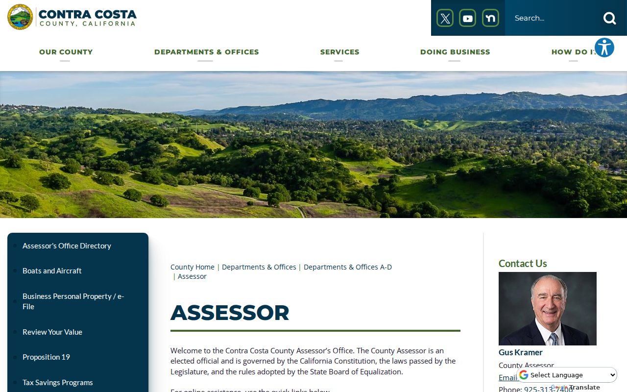
The county capture links Brentwood address research to the Assessor and separates the roll from the web map.
Browse Brentwood Streets in CCMAP and GeoVault
CCMAP is the county parcel view for a street directory search. Locate the subject APN, zoom to clear polygons, click each lot, and record neighboring APNs. The viewer documents a radius capability. The online map is free, while a staff radius search is listed at $50. It supplies parcel context, not owner names or a current household.
Brentwood GeoVault adds city layers when a street crosses a planning or service boundary. The city describes APN, address, and owner-name searches for zoning reports; its layer inventory exposes addresses, parcels, roads, city limits, footprints, annexations, subdivisions, districts, and aerial context.
Use the GeoVault layer inventory when a simple street search needs more context than a parcel outline.
The GeoVault map image shows the visual side of address research: parcels and nearby land can be compared before any name-based record is requested.
The city also published a 2017 Street and Address Map. It is page-indexed, shows address numbers rather than residents, and can rescue a spelling or house-number sequence that defeats autocomplete.
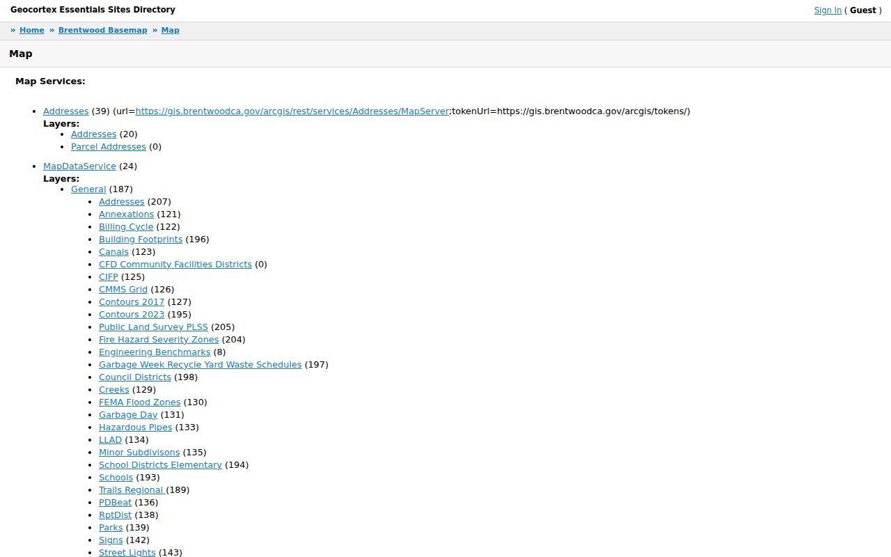
The capture links a street number to public boundaries for permits, services, and later research.
Brentwood Situs, Parcel, Plat, and Mailing
Address terms carry different evidence. Brentwood address research is easier to read when the land key, physical location, and correspondence destination stay separate. A legal description can outlast a street label, while a mailing address can point away from the parcel.
- Parcel
- A mapped unit of land with an APN, boundary, and assessment identity. One parcel can have more than one structure or address context.
- Situs address
- The physical location assigned to the land. It is not a promise that the assessee or a household member lives there.
- Plat
- A recorded subdivision or survey map that shows lots, blocks, lines, roads, or easements used to read a legal description.
- Criss-cross directory
- A reverse directory organized by street address so a researcher can work from a place toward an occupant entry when a local volume contains that section.
Keep the situs, mailing address, APN, legal description, and source date together. The recorder index may omit the modern street address, so the address result is strongest when the same parcel or legal description joins the sources.
Brentwood RecorderWorks Search Modes
The Contra Costa recorded-document hub leads to RecorderWorks, the person-organized index for Brentwood deeds. Verified online coverage begins in 1986. Search by person or business, APN, legal description, document number, book and page, map type, or date. Person mode accepts LAST FIRST, partial matches, and “Allow Partial Match.” The general gateway did not publish a separate earlier cutoff, so pre-1986 work belongs at the counter or in legacy material.
| RecorderWorks control | Use in an address search |
|---|---|
| Global Search | Optional text search that may take about a minute |
| Person or Business Name | Enter a party, try spelling variants, and search both roles |
| From and To Dates | MM/DD/YYYY range to narrow a common name |
| Document Number range | Year plus the seven-digit sequence when a reference is known |
| Book and Page | Legacy reference mode where the document supplies that citation |
| APN or Legal Description | Land-based modes for cases where the street address is absent |
| Document Type and Map Type | Optional multi-select filters with date controls and hundreds of document classes |
Useful classes include DEED, DEED (2015 & PRIOR), DEED OF TRUST, TRUSTEES DEED, quitclaim, LIEN, MECHANICS LIEN, NOTICE OF DEFAULT, RECONVEYANCE, RELEASE, LEASE, easement, subdivision, parcel, survey, historical and cemetery maps, decree of distribution, judgment, and affidavit of death. Search is free; selected documents move to the Shopping Cart. Verify copy charges at checkout.
A hit may show party and role, instrument type, recording date, number, and book/page. The image can add grantor, grantee, legal description, stamp, and return address. A street address may be missing, so carry the APN or legal description across Brentwood.
Build a Brentwood Deed Chain by Street
In a Brentwood street directory, a deed chain answers who transferred an interest in a parcel, not who lived there each night. The grantor transfers an interest; the grantee receives it. Start with the current assessee and legal description, find the acquisition instrument, then search the seller as an earlier grantee. Confirm each link with the same APN, lot, block, subdivision, or legal description.
Deeds of trust identify financing parties, reconveyances and releases mark lien events, and notices date recorded events. Consideration may sit in a tax declaration rather than a sale-price field, while a January 1 assessee can lag a transfer. Record what the instrument proves and what it does not.
- Party name and role, including grantor or grantee.
- Document type, recording date, and instrument number.
- Book and page or another legacy reference, when shown.
- Legal description, APN, map reference, and parcel continuity.
- Image access, redactions, and the custodian's copy terms.
For one address backward through time, use the Brentwood previous residents house-history workflow; retain the street's land sequence and limits here.
Brentwood Permits, Annexations, and Address History
City planning and permit records add a project timeline to a Brentwood street directory. A retained file may name an applicant, owner, contractor, work description, valuation, and application, issue, or final date. The final date can date an alteration, but it does not establish every occupant.
Community Development is the fallback when a project tool is incomplete. City Hall is at 150 City Park Way, Brentwood, California 94513, phone 925-516-5400, weekdays 8 to 5; Community Development is listed at 925-516-5405. Give the exact address or APN, project number, department, and date range. The city's public-records request route remains subject to redaction.
Use GeoVault Annexations and Subdivisions with the address map when an old address does not match a parcel. Brentwood incorporated in January 1948, and no verified global street-renumbering schedule was located. Record that gap rather than forcing an old number into a modern location.
California Voter Records on a Brentwood Street
California voter tools do not provide a browseable Brentwood street directory. The self-status route asks for first name, last name, date of birth, and an ID or partial Social Security identifier when required. A county or address choice can route the person to local districts. The result verifies the person who supplies the identifiers, not a street list.
A regulated voter file may contain name, residence and mailing address, registration status and date, party, precinct, districts, and election participation history where lawful. Driver-license data, Social Security data, signatures, and full sensitive identifiers are not public. Elections Code sections 2194 and 2188 require a requester to state entity, geography, purpose, delivery, and security in the county or Secretary of State application; the custodian quotes extraction charges.
Use the California voter-status instructions for a willing person's own check and the county elections office for an authorized file request. Safe at Home suppresses protected residence addresses, and an inactive record is not proof of a move.
Can a Brentwood voter-status result list everyone on a street? No. It verifies an individual or supports a regulated request, not an open neighbor roster.
Brentwood Street Directory History in Print
Historical address work fills the gap between a recorded owner and a past occupant. The library holdings record lists Brentwood News from 1902 onward, NewsBank from July 2001 onward, and Antioch film from March 1937 through September 1998. Those formats carry obituaries, society items, property notices, and permit stories. Search names with and without diacritics.
The exact Brentwood city, telephone, and reverse-directory run was not established. Check the library catalog, History Center, FamilySearch, and local volumes title by title. A criss-cross section can convert an address into an occupant entry, but an unverified run remains a gap. Broader collections belong with the Brentwood city directory research.
Free PACT terminals at the Contra Costa County History Center search digitized photographs, nineteenth-century newspapers, maps, county histories, Nilda Rego columns, and the general collections database. Staff research is $20 per hour for members or $30 for nonmembers. Physical indexes, film, maps, and yearbooks show why not every Brentwood street record is online.
Brentwood Street Directory Privacy Boundaries
A street directory cannot show a complete present household. The assessment roll identifies an assessee, the deed index identifies recorded parties, and permits identify project actors. Non-owner occupants, household members, utility customers, delivery recipients, and DMV account holders are not supplied. A mailing address, trust, corporation, manager, or stale tax date can defeat an owner-to-occupant assumption.
California address confidentiality rules also matter. Safe at Home can substitute an address and forward mail for eligible participants, including protected voters, but it does not erase every old deed or cached copy. Public records may be corrected through the custodian when a narrow statutory redaction applies. The lawful path is to use the minimum record needed for a personal, historical, civic, or safety purpose and to verify it with the office that holds it.
Lawful use. Brentwood street and address records are for lawful personal research, family history, and civic understanding. Do not use a street directory to stalk, harass, intimidate, or harm anyone; California law places clear limits on repeated following and harassing communications.